In August of 2015, Bill Wren from McDonald Observatory took measurements from the top of Enchanted Rock to determine sources of light pollution. He used equipment on loan from the National Park Service to make a panorama photograph of the night sky. The measurements were processed by the National Park Service to subtract natural light sources like the Milky Way to reveal only man made (anthropogenic) sources of light – in other words light pollution.
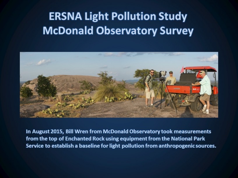
In the image above, Bill Wren (McDonald Observatory), Matt Lara (Hill Country Alliance), Scott Whitener (Interpretive Ranger) and Doug Cochran (Park Superintendent) are setting up the National Park Service equipment on the tripod to take panoramic images of the night sky.
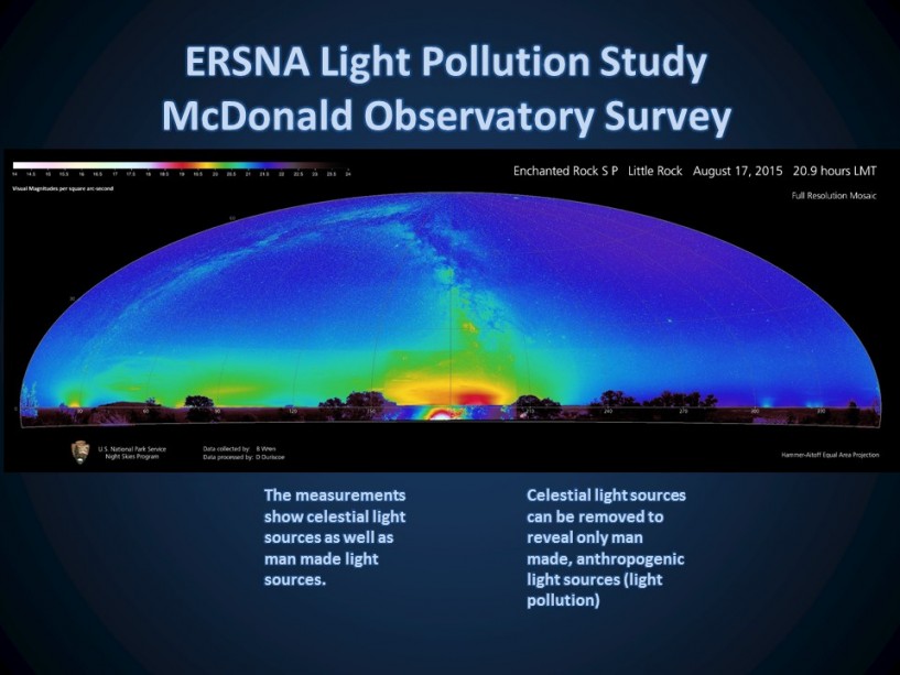
In the image above, both natural light sources (Milky Way) and man made light sources (anthropogenic) are shown in the raw data)
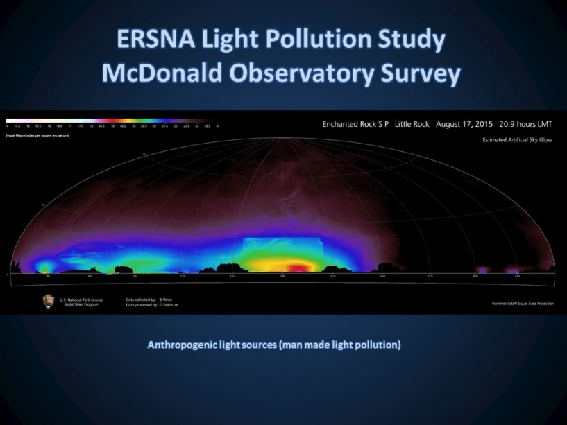
In the image above, the natural light sources have been removed to reveal only the anthropogenic light sources. By comparing the light sources to the azimuth scale on the bottom of the image, the source of the light can be estimated.
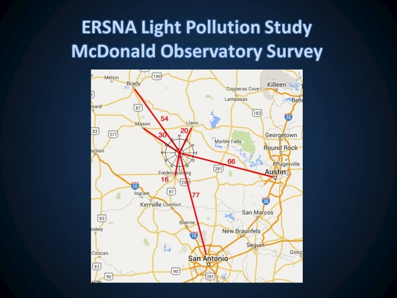
The image above shows ERSNA as the center of the compass and the relative direction and “air mile” distance of the anthropogenic light sources from Enchanted Rock.
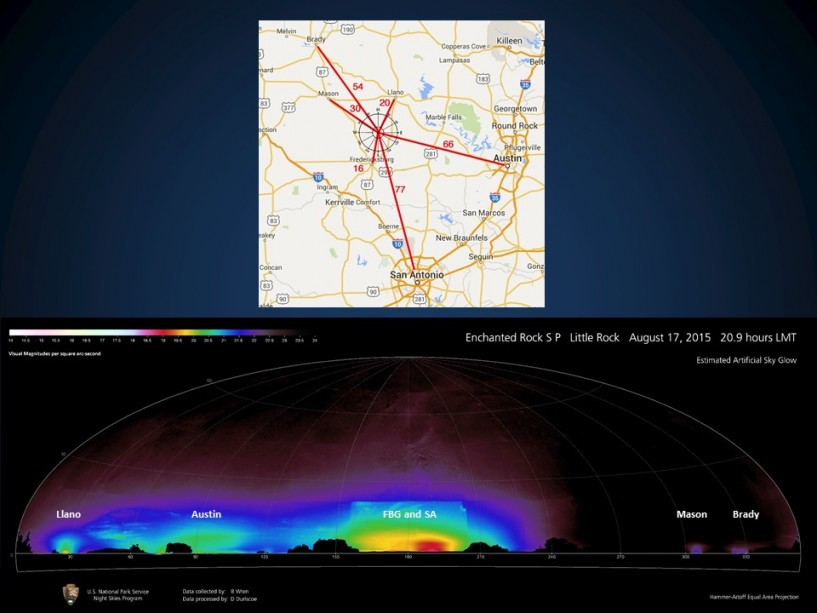
The image above shows the compass graph above the anthropogenic light sources with the light sources labeled to correspond to their direction and city. Fredericksburg and San Antonio are in the middle with a heading of 180 degrees or South. Llano is about 25 degrees or slightly East of North. Austin is about 100 degrees or slightly South from East. Mason and Brady are approximately Northwest.
The study will be used as a baseline to monitor future light pollution.
